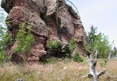
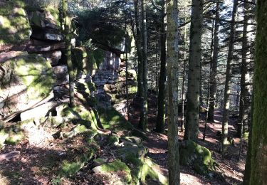
Trail Walking La Grande-Fosse - Le Parc Éolien du Bois de Belfays (version longue) - Photo

Le Parc Éolien du Bois de Belfays (version longue)

© OpenStreetMap contributors
Length
Length
14 km
Max alt
Max alt
822 m
Uphill gradient
Uphill gradient
527 m
Km-Effort
Km-Effort  
21 km
Min alt
Min alt
557 m
Downhill gradient
Downhill gradient
526 m
Boucle
Boucle
Yes
Creation date :
2024-02-19 09:57:47.014
Updated on :
2024-03-04 14:46:40.409

(0 Reviews)

Walking
Walking
4h50
Difficulty : Difficult

Scan this QR Code to open this trail in the SityTrail application

FREE GPS app for hiking

Logo SityTrail SityTrail

IGN / Geographical institutes

Download SityTrail from the App Store Download SityTrail from Google Play

Logo SityTrail SityTrail World

The world is yours!

Download SityTrail from the App Store Download SityTrail from Google Play Download SityTrail on Huawei AppGallery

About

Trail Walking of 14 km to be discovered at Grand Est, Vosges, La Grande-Fosse. This trail is proposed by vaillantjm.

Elevation profile

Points of interest

Point of interest La Grande-Fosse - Jonction route - Photo
vaillantjm
LA GRANDE-FOSSE 
Point of interest Ban-de-Sapt - Bifurcation. Proche de la source de la - Photo
vaillantjm
Point of interest Ban-de-Sapt - Intersection - Photo
vaillantjm
BAN-DE-SAPT 
Point of interest Ban-de-Sapt - Carrefour de chemins - Photo
vaillantjm
Point of interest Châtas - Croix des Fourrières - Photo
vaillantjm
Point of interest Châtas - Jonction route - Photo
vaillantjm
Point of interest Grandrupt - À gauche vers les éoliennes - Photo
vaillantjm
Point of interest Grandrupt - Stèle - Photo
vaillantjm
GRANDRUPT 
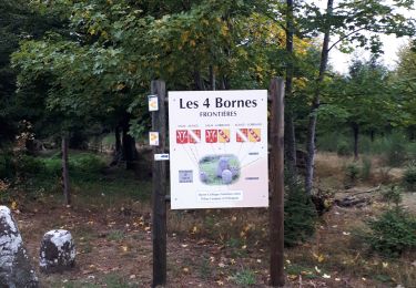
Point of interest La Grande-Fosse - Carrefour des Quatre Bornes - Photo
vaillantjm
Point of interest La Grande-Fosse - À droite direction les Quatre Bornes - Photo
vaillantjm
Point of interest La Grande-Fosse - Pré Leroy - Photo
vaillantjm
LA GRANDE-FOSSE 
Point of interest La Grande-Fosse - Traversée de la D32 - Photo
vaillantjm
LA GRANDE-FOSSE 
Point of interest La Grande-Fosse - Bifurcation chemin - Photo
vaillantjm
LA GRANDE-FOSSE 

Positioning

Country:
France
Region :
Grand Est
Department/Province :
Vosges
Municipality :
La Grande-Fosse
Location:
Unknown
Start:(UTM)
355704 ; 5355644 (32U) N.

Trails nearby

Trail Walking La Petite-Fosse - L'Ormont : Un massif en or massif  (La petite Fosse) - Photo
Walking
tracegps

Walking

Difficult
(1)
La Petite-Fosse, Grand Est, Vosges, France
10.2 km | 16 km-effort
3h 45min
Yes
Trail Horseback riding Ban-de-Sapt - Circuit LB ban_de_sapt-climont2 - Photo
Horseback riding
GUIDE+

Horseback riding

Difficult
(1)
Ban-de-Sapt, Grand Est, Vosges, France
27 km | 39 km-effort
4h 44min
No
Trail Horseback riding Ban-de-Sapt - Boucle BanDeSapt Quatre Bornes - Photo
Horseback riding
GUIDE+

Horseback riding

Medium
Ban-de-Sapt, Grand Est, Vosges, France
18.9 km | 26 km-effort
3h 13min
Yes
Trail Horseback riding Ban-de-Sapt - Ban de sapt Laitre le rouaux moulin de lavaux  - Photo
Horseback riding
Adelinenuggets

Horseback riding

(1)
Ban-de-Sapt, Grand Est, Vosges, France
11.3 km | 15.6 km-effort
1h 35min
No
Trail Walking Saint-Dié-des-Vosges - Ormont 16kM - Photo
Walking
1957

Walking

Very difficult
Saint-Dié-des-Vosges, Grand Est, Vosges, France
14.6 km | 27 km-effort
5h 20min
Yes
Trail Walking Saint-Dié-des-Vosges - Ormont- 15km - Photo
Walking
1957

Walking

Very difficult
Saint-Dié-des-Vosges, Grand Est, Vosges, France
14.4 km | 26 km-effort
5h 10min
Yes
Trail On foot Saales - Saales, les 4 Bornes, le Spitzemberg - Photo
On foot
oscar1

On foot

Medium
Saales, Grand Est, Bas-Rhin, France
21 km | 30 km-effort
Unknown
Yes
Trail Walking Saales - Les crêtes de Saâles - Photo
Walking
VacheKiri67

Walking

Medium
(2)
Saales, Grand Est, Bas-Rhin, France
13.5 km | 18.6 km-effort
4h 43min
Yes
Trail Horseback riding Ban-de-Sapt - Circuit LB ban_de_sapt-climont - Photo
Horseback riding
GUIDE+

Horseback riding

Medium
Ban-de-Sapt, Grand Est, Vosges, France
18.2 km | 26 km-effort
3h 13min
No


Close
My subscriptions